Here are the submissions for the final project.
Presentation
Written Summary
Tuesday, April 27, 2010
Tuesday, April 06, 2010
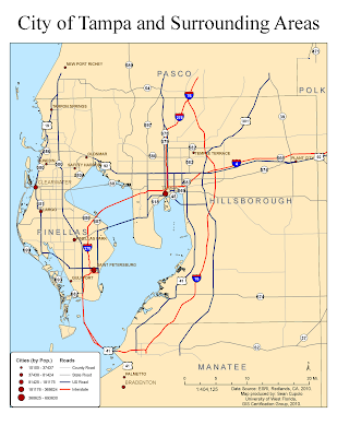
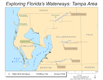
The posted maps were completed for the Week 11 Lab for the University of West Florida Online GIS Certification program class, Introduction to Geographic Information Systems (GIS 4043/L). The maps was created using the ArcGIS ArcMap program and based on data from ESRI Virtual Campus courses.
Creating and Editing Labels and Annotation
I was planning on taking this ESRI course anyway so doing it for class worked out well. I'm going to go back and do the Annotation module over the break between classes provided I can do so.
Here are the two maps from the ESRI exercises:
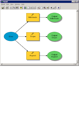
Learning ArcGIS Spatial Analyst
The first part of the ESRI Spatial Analyst Tools course focused on process models. The following image is the process model created for the exercise:
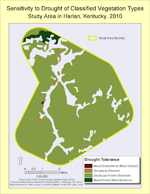
 The second part focused on reclassifying data. The map below shows the vegetation layer reclassified and masked to show new classifications based on drought tolerance within a predefined study area:
The last map was created from the ArcGIS 3D Analyst module:
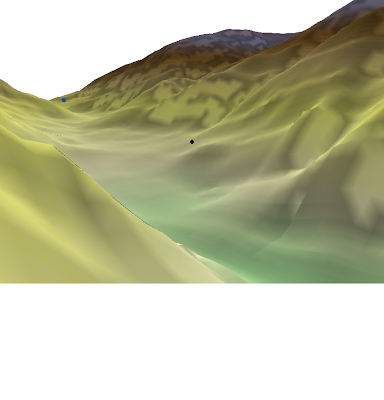
I actually went through, finished the module and passed the exam. I wanted to make a video but was not sure how to do it so just decided to post this image. I was not sure how to get the image though but found that you could post it to the clipboard which is what I did and then posted the clipboard to the Paint program to save it as a PNG file. I hope to go back and play with the Fly features some time in the future.
Creating and Editing Labels and Annotation
I was planning on taking this ESRI course anyway so doing it for class worked out well. I'm going to go back and do the Annotation module over the break between classes provided I can do so.
Here are the two maps from the ESRI exercises:


Learning ArcGIS Spatial Analyst
The first part of the ESRI Spatial Analyst Tools course focused on process models. The following image is the process model created for the exercise:
 The second part focused on reclassifying data. The map below shows the vegetation layer reclassified and masked to show new classifications based on drought tolerance within a predefined study area:
The last map was created from the ArcGIS 3D Analyst module:

I actually went through, finished the module and passed the exam. I wanted to make a video but was not sure how to do it so just decided to post this image. I was not sure how to get the image though but found that you could post it to the clipboard which is what I did and then posted the clipboard to the Paint program to save it as a PNG file. I hope to go back and play with the Fly features some time in the future.
Subscribe to:
Posts (Atom)
